
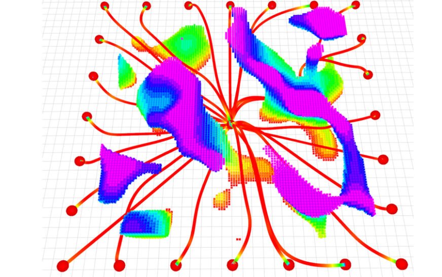
New Trajectory-Planning System Enhances UAVs for Search and Rescue Operations
In the wake of a catastrophic earthquake, unpiloted aerial vehicles (UAVs) could play a crucial role in navigating through collapsed structures to map the area and provide vital information for rescuers. However, enabling an autonomous robot to dynamically adjust its flight path in response to sudden obstacles while maintaining its trajectory remains a significant challenge.
Researchers at MIT, in collaboration with the University of Pennsylvania, have introduced a pioneering trajectory-planning system that addresses these challenges simultaneously. This innovative technique allows UAVs to react to obstacles within milliseconds while following a streamlined flight path that optimizes travel efficiency.
The system employs a novel mathematical formulation that guarantees safer navigation towards a target along a viable route, making it less computationally demanding compared to existing methods. Consequently, it generates smoother trajectories at a speed surpassing that of many state-of-the-art techniques.
Dubbed MIGHTY, the open-source trajectory planner operates solely on the UAV’s onboard computer and sensors, requiring no expensive proprietary software. This feature enhances its accessibility for deployment in a wide array of real-world applications.
Besides its potential for search-and-rescue missions, MIGHTY can also be utilized for last-mile delivery services in urban environments, where UAVs must navigate around buildings, overhead wires, and pedestrians. Additionally, it has applications in the industrial inspection of complex structures like wind turbines.
“MIGHTY achieves comparable or superior performance using only open-source tools, enabling any researcher, student, or company globally to utilize it without financial constraints. This democratization of high-performance trajectory planning will expand its use, paving the way for a broader community to build upon this work,” explains Kota Kondo, an aeronautics and astronautics graduate student and lead author of the paper detailing the trajectory planner.
Addressing Key Challenges
Kondo’s inspiration for developing autonomous robots stemmed from witnessing the Fukushima Daiichi nuclear disaster aftermath, where emergency workers ventured into perilous environments. He envisions a future where robots can operate in dynamic, hazardous situations, gathering data while keeping human operators safe.
For such missions, an advanced trajectory planner is vital; it guides robots safely from point A to point B. However, many current systems impose trade-offs that can hinder performance. While some commercial solutions provide rapid trajectory generation, they often come with exorbitant price tags, sometimes exceeding hundreds of thousands of dollars. Open-source alternatives typically underperform or present usability challenges.
Through MIGHTY, Kondo and his team have crafted a system that not only generates high-quality, smooth trajectories but also adapts to real-time obstacles—all while being fast enough to operate using standard onboard components. They tackled the challenge of rapid trajectory generation, which is a common limitation in open-source systems.
Conventional methods estimate travel time from point A to point B as a starting point, then derive the best path to the goal from this fixed travel time. While this approach facilitates rapid trajectory generation, it can lead UAVs to accelerate excessively when navigating around obstacles, complicating hazard avoidance.
A Revolutionary Approach
MIGHTY, on the other hand, employs a mathematical technique known as a Hermite spline, simultaneously optimizing travel time and flight path to create smooth trajectories that can be finely controlled. “Optimizing spatial and temporal components together yields superior results; however, it increases the optimization’s complexity, making it harder to resolve within a practical timeframe,” Kondo notes.
The research team innovatively alleviated this computational burden by making an initial trajectory estimate rather than starting from scratch with each computation. This estimate is then refined iteratively based on maps created using the UAV’s lidar sensors, allowing it to react to unforeseen obstacles in real-time while maintaining a smooth trajectory and efficient travel time.
In simulated experiments, MIGHTY demonstrated a need for only 90 percent of the computation time required by leading methods while achieving destinations approximately 15 percent faster. In practical tests, it reached speeds of 6.7 meters per second, successfully avoiding all encountered obstacles.
Future plans for MIGHTY include enhancing its capabilities for multi-robot operations and conducting flight tests in more challenging environments. The researchers aim to continue improving this open-source system by incorporating user feedback.
Davide Scaramuzza, a professor and director of the Robotics and Perception Group at the University of Zurich, remarked on MIGHTY’s contributions, emphasizing the significance of integrating the trajectory’s geometric and temporal elements. His insights highlight how MIGHTY facilitates rapid, dynamically feasible movements for robots navigating cluttered settings.
This research received funding from the United States Army Research Laboratory and the Defense Science and Technology Agency in Singapore.